What if most of your day could happen without sitting in Houston traffic? If you want an easy, low‑maintenance lifestyle near Rice University, the Museum District, and Hermann Park, University Place can make driving the exception. In this guide, you’ll see how METRORail, bike routes, and walkable spots fit into daily life, what to look for in a home, and a simple checklist to test a car‑light routine for yourself. Let’s dive in.
University Place at a glance
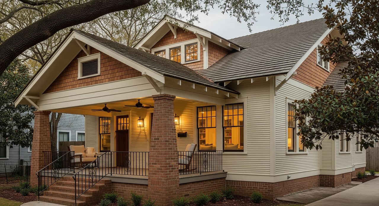
University Place sits beside Rice University, Hermann Park, and the Houston Museum District. The METRORail Red Line stops by Hermann Park and the Museum District, which are the most practical rail access points for many blocks here. Depending on your exact address, the nearest station is often a short walk of a few minutes to about 15 minutes. That is why it helps to time the walk from the specific property you are considering.
METRORail and transit basics
Red Line access nearby
The Red Line runs north to south through central Houston with key stops near Hermann Park, Rice University, and the Museum District. From those stations, you can reach Downtown, Midtown, the Texas Medical Center, and NRG Park without getting in a car. Review current routes and station details using the official METRO route maps and Red Line info.
Trips you can make car‑free
If you work or study Downtown, in Midtown, or in the Texas Medical Center, the Red Line often provides a reliable option that avoids parking and peak‑hour traffic. Many residents find rail connections competitive with driving when you include parking, especially for peak hours or major events. For the most accurate timing, plan your door‑to‑door trip with the METRO Trip Planner and service alerts at the times you expect to travel.
Schedules, fares, and late nights
Train frequency varies by time of day and day of week. If you work early, late, or weekends, double‑check current schedules, planned construction, and fare or transfer rules before you rely on transit for a regular commute. You can confirm all current details on the official METRO Trip Planner and service alerts.
First and last mile options
Your walk to the station may be short, but you can also connect by bike or bus when you need to save time. Micromobility options, such as e‑scooters or bike share, can change based on city permits and operators. Always verify the latest options and rules before you plan your routine.
Bike routes and tips
Where bikes fit best
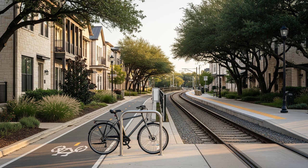
University Place and the Rice and Museum areas are friendly to intermediate riders. The street grid, short distances, and access to park paths make cycling a practical choice for errands and short commutes. Off‑street paths in Hermann Park offer relaxed riding, and regional bayou bikeways can extend your reach to other neighborhoods.
Plan routes and find facilities
Look for properties with protected or buffered bike lanes nearby, painted lanes, or calm, low‑traffic streets. Secure bike storage matters too, especially for e‑bikes. To map your rides and confirm the latest bikeways, use the City of Houston Bicycle Master Plan along with digital maps that show bicycle layers.
Stay comfortable and safe
Houston heat can make midday rides uncomfortable. Many riders prefer early morning or evening trips and shaded routes through parks where possible. After heavy rain, some routes can hold water, so check your elevation and drainage, and keep an alternate route in mind.
Walkability and daily conveniences
Everyday destinations
From many blocks in University Place, you can walk to Rice Village for a dense mix of restaurants and services. Hermann Park is close for green space, trails, and performances at Miller Outdoor Theatre. The Museum District’s cultural institutions, including those listed by the Houston Museum District Association, are nearby for easy outings with guests.
Groceries, healthcare, and campus access
You will find supermarkets, pharmacies, coffee shops, and neighborhood restaurants within short walking or biking distance from central blocks, though exact times vary by address. Healthcare access is straightforward, with the Texas Medical Center a short transit or bike ride away. If you have ties to Rice University, review campus access points and commuter options through Rice University Transportation resources.
Measure walkability on the ground
Scores can be helpful but they are only a starting point. Check a quick indicator such as Walk Score, then walk the route to your closest grocery, pharmacy, and rail stop at the time of day you would normally go. Pay attention to sidewalk continuity, curb ramps, and crosswalk timing. In the evening, note lighting and active street life near your most frequent destinations.
Housing features for car‑light living
What to look for inside the building
Prioritize secure bike storage. That can be a locked bike room, sturdy racks in a garage, or flexible in‑unit space for one or two bikes. If you own an e‑bike, confirm power access and any HOA rules about charging or storage in common areas.
Parking and visitor logistics
If you plan to keep a car or host guests, check resident parking limits and guest parking policies. Some condos or HOAs set rules on the number of vehicles, where guests can park, or require permits. If you rarely drive, a home with minimal required parking and reliable on‑street options may fit your lifestyle.
Transit‑adjacent tradeoffs
Homes closer to rail or bus stops offer more convenience, though they can have higher foot traffic and noise. Quieter residential blocks give you a calmer setting but might add a few minutes to your walk or bike ride. Decide which tradeoff suits your routine best.
Maintenance and risk checks
Low‑maintenance homes such as townhomes or condos reduce yard work so you can spend more time walking or riding. Always review HOA rules that could affect daily life, like pet policies or use of amenities. In Houston, flood risk is an important factor that can affect walking and biking after storms. Before you buy, check property‑level risk using Harris County Flood Control District flood maps and ask about any past water events.
Buyer checklist: test a car‑light routine
- Walk from the property to the nearest METRORail stop and time it in the morning and evening.
- Try a complete commute using METRO at a likely departure time. Note total time and transfers.
- Bike a typical route, like to work, a grocery, or the rail stop. Note traffic stress and the lane type.
- Verify secure bike storage and in‑unit space for bikes or gear.
- Check for continuous sidewalks and evaluate crosswalks on your routes to stores and transit.
- Identify the nearest grocery, pharmacy, and clinic, and time how long it takes to walk, bike, or ride transit to each.
- Ask the seller or HOA about resident parking rules, guest parking, and any vehicle limits.
- Check flood maps for the exact address and ask the seller about past water events.
- Review current METRO route alerts and confirm any local micromobility options.
- Walk the neighborhood in the evening to assess lighting and how active the streets feel.
Real‑life scenarios to consider
Single professional working Downtown
You may be able to walk or bike to the Red Line, ride to Downtown, and skip parking entirely on most days. Groceries and dining can stay local near Rice Village. For occasional long trips or heavy errands, use delivery, rideshare, or a short‑term car rental.
Graduate student or university staff
Living near the campus edge can keep daily trips under a mile. A folding or lightweight bike can help bridge first and last mile gaps and simplify storage. Transit to the Texas Medical Center is straightforward, and the museum and park network adds variety to daily routines.
Small household with varied schedules
A car‑light setup can work if you plan for late evenings and weekends. Confirm rail and bus frequency at off‑peak times before you commit. For school and childcare, map door‑to‑door routes, test them at typical times, and keep a backup plan for rain days.
Tools and resources
- Review lines, stations, fares, and alerts with the official METRO route maps and Red Line info.
- Check a quick neighborhood indicator with Walk Score, then verify on foot.
- Plan bike routes using the City of Houston Bicycle Master Plan alongside your preferred mapping app.
- If you rely on the campus, see Rice University Transportation resources for access points and commuter info.
- Before you buy, confirm flood risk with Harris County Flood Control District flood maps.
- For broader context, explore U.S. Census commuting data to understand regional mode share trends.
Ready to find a home that matches your routine, not the other way around? Let’s walk the blocks together, test the routes, and align your shortlist to a car‑light lifestyle that actually works. Schedule your next step with Monique McDaniel.
FAQs
Is car‑light living realistic in University Place?
- It can be, especially if you live within a short walk to Red Line stations and key services; test your routes, timing, and backup options before you decide.
How do I estimate METRORail commute time to Downtown?
- Use the METRO Trip Planner and service alerts to map your door‑to‑door trip at your normal departure time, then test it once in person.
What if I have children or irregular shifts?
- A car‑light routine can still work if you confirm late‑night and weekend schedules, map school and childcare routes, and keep a backup like rideshare for off‑hours.
Are groceries and pharmacies walkable from most blocks?
- Many central blocks offer options within a 5 to 15 minute walk or short bike ride, but distance varies by address, so verify with Walk Score and a real‑world walk.
How do I store and protect an e‑bike?
- Choose a home with secure, covered storage, confirm HOA or building rules on charging and storage, and consider a quality lock and insurance for higher‑value bikes.
How do I handle big errands without a car?
- Combine delivery for heavy items with rideshare or short‑term rentals for occasional trips, and use transit or a bike for routine shopping.
What about flooding on walking or biking routes?
- Check address‑level risk on Harris County Flood Control District flood maps and keep alternate routes in mind after heavy rain.